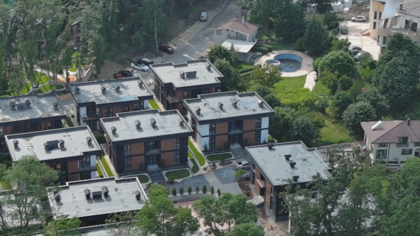
Experts from the National Centre for Geospatial Research and Technologies at Sofia University have carried out a complete laser scan using a drone of the illegal settlement in the Baba Alino area near Varna. The data will show the parameters of the construction and how the territory has been altered. The area was captured in a 3D model with an accuracy of 2–3 centimetres.
The study covers an area of approximately 500 decares. It was initiated by the Varna branch of the Chamber of Architects, which will analyse the data and announce within a month which structures have been built illegally. The results will also be submitted to the Ministry of Regional Development and Public Works.
Professor Stelian Dimitrov, Director of the National Centre for Geospatial Research and Technologies at Sofia University: “We will have a complete digital model of the entire area. We will be able to digitally remove the vegetation and see absolutely all human-made structures within this territory.”
New revelations in the “Baba Alino” case: illegal water supply installations have been discovered in the complex near Varna
Architect Marin Velchev, Regional College in Varna of the Chamber of Architects in Bulgaria: “In addition to the building stock being surveyed, roads, infrastructure, and everything constructed on the terrain will also be recorded. This will allow us to compare what existed before and what has been newly built.”


 Чуй новините
 Подкаст