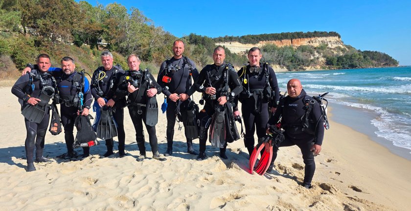
An underwater archaeological expedition by the National Historical Museum in the bay near Cape Killick has unveiled the secrets of the ancient harbour area of the Erite fortress, the museum announced. The expedition took place from 17 to 23 September 2025 in the waters near Cape Killick, close to the village of Bliznatsi, Avren Municipality – an area considered one of the least explored underwater sites along Bulgaria’s northern Black Sea coast.
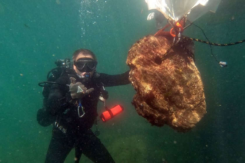
The underwater archaeological research was conducted under the supervision of Prof. Dr. Ivan Hristov. The expedition involved divers from the National History Museum, employees of the National Security Service, as well as volunteers and friends of the museum.
Initial investigations carried out in 2023 led to the discovery of a number of valuable finds related to ancient navigation in the Western Pontus: amphorae, stone anchors, a tin ingot, iron anchors, and the remains of a late-medieval shipwreck. Based on these discoveries, archaeologists hypothesised that the Cape Killick area had served both as a shelter for ships during bad weather and as an active harbour supporting the ancient settlement of Erite.
“The aim of the second phase of the research was to determine the boundaries of the harbour zone associated with the late-antique Erite fortress, as well as to map important underwater features – rocks, reefs, and concentrations of movable cultural objects,” the museum summarised.
The Erite fortress itself is marked on the well-known ancient Tabula Peutingeriana map. According to this map, along the Black Sea coast within the province of Moesia Secunda there were road stations, including Odessos (Varna), Erite (near the mouth of the Kamchia River), and Templum Jovis (likely near present-day Obzor). All three served as significant harbour centres, located either directly on the coast or at river mouths – in other words, safe harbours.
Photos by National Museum of History
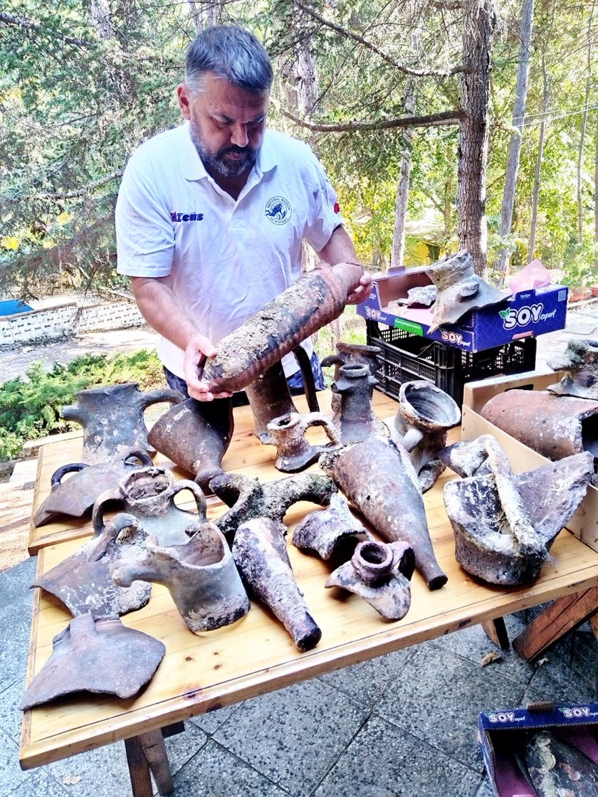
During this year’s underwater expedition, 348 fragments of ancient and late-antique ceramic vessels and amphorae were recorded. Among them were amphorae originating from Heraclea, Chios, the island of Kos, as well as Roman amphorae of types LR1 and LR2, North African amphorae, and others. The fragments cover a wide chronological range, reflecting the inventory of vessels and the typical accumulation of materials in harbour areas.
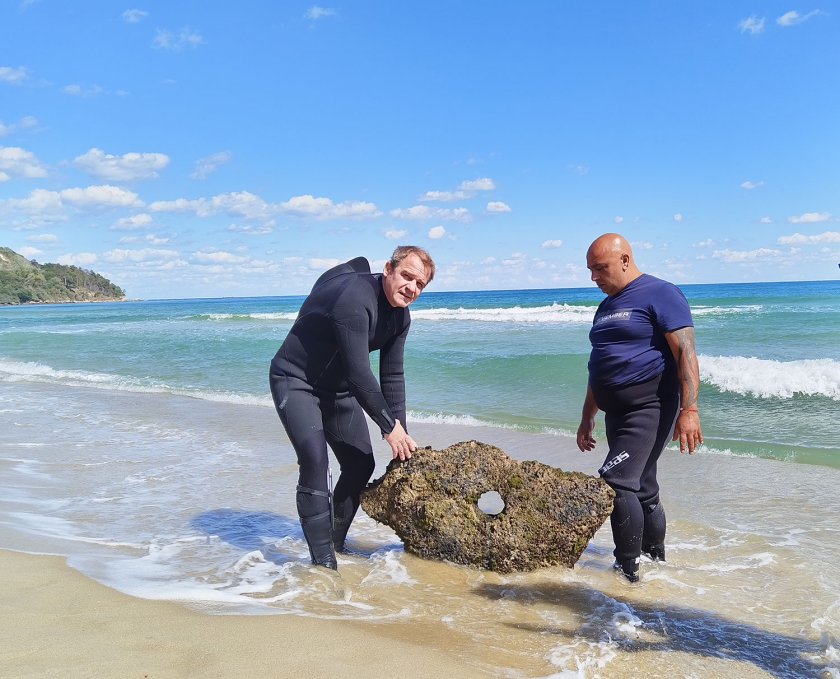
Among the earliest finds were three stone anchors with a single hole, which can be dated as early as the beginning of the 1st millennium BCE.
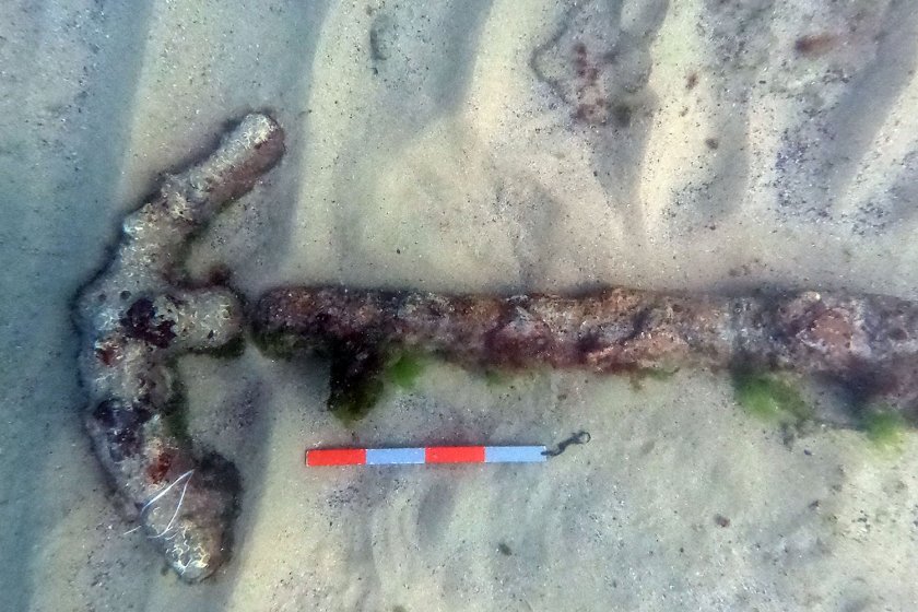
Of particular value are three iron anchors from the Roman period. They belong to Type B, known in scholarly literature as “early Roman imperial” according to the classification of G. Kapiten. Also of interest is an iron anchor from the medieval period – Type E (using the same classification), characteristic of the 7th–11th centuries. This is the only confirmed evidence of the bay’s use during the Middle Ages.
Based on the collected data, it can be concluded that the waters south of Cape Killick functioned as a cargo-handling area from the beginning of the 1st millennium BCE until the early 7th century CE. Several vessels sank there during the late medieval period. The geomorphology of the cape, which in the past likely projected further into the sea, formed a naturally sheltered harbour area. In bad weather, this zone would have provided a safe haven for ships unable to dock safely at the mouth of the Kamchia River.
Excavations of the Erite fortress are planned, where archaeologists can expect further exciting discoveries.


 Чуй новините
 Подкаст